Related Web-sites
|
On the cutting edge of new interests, language analysis has left the spheres of Arts departments behind. Artificial intelligence has opened computer science departments’ doors to it, statisticians and mathematicians via data-mining and graph theory have allowed it to approach the concepts of abstraction and analogy in practice, geographers have offered it cartographical metaphor as a means of representation, architects and artists have opened the doors of cyberspace and virtuality. Moreover, with the Internet’s development all these disciplines have found new possibilites of exercising their talents for understanding and representing this new universe and faciliting navigation through it, for transforming data, identified by means of ever more "intelligent" information gathering research engines. Language is now treated in many often surprising ways : it’s counted, it’s cut up, it’s simplified, purified, structured via (hyper)links which compose it like a system of fitting boxes, superposed or opening into one another. These processes are in turn associated with representational means new both as to the form and meaning of text : maps, constellations, trees, tubes, mountains, etc. |
A la croisée d’intérêts nouveaux, l’analyse du langage a quitté les sphères des facultés de Lettres. L’intelligence artificielle lui a ouvert les portes des facultés d’informatique, les statisticiens et mathématiciens via le data-mining et la théorie des graphes lui ont permis d’approcher par la pratique les concepts d’abstraction et d’analogie, les géographes lui ont offert la métaphore cartographique comme mode de représentation, les architectes et les artistes ont ouvert les portes des cyber-espaces et de la virtualité, De plus, toutes ces disciplines trouvent dans le développement d’Internet de nouvelles possibilités d’exercer leurs talents pour comprendre et représenter ce nouvel univers et en faciliter la navigation, pour transformer des données, identifiées à l’aide de moteurs de recherche de plus en plus "intelligents", en une information. Actuellement, le langage est traité de nombreuses manières souvent inédites: on le compte, on le découpe, on le simplifie, on le purifie, on le structure via les (hyper)liens qui le composent comme un système de boîtes encastrées, superposées ou s’ouvrant les unes dans les autres. A ces traitements s’associent des formes de représentations nouvelles tant de la forme que du sens du texte: cartes, constellations, arbres, tubes, montagnes, etc. |
| These websites are some initiatives we found on the net that inspired us or that we found "interesting". | Ces sites sont quelques unes des initiatives que dnous avons découvertes sur le net ou autre part, il sont présentés ici car ils nous ont inspirés ou (plus simplement) nous les trouvons "intéressants". |
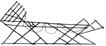
| "Among the maps of peoples said to be primitive, there exists a unique group of nautical maps of the Marshall Islands in the Pacific Ocean. Constructed out of rush bound together, these maps are real models employed by the inhabitants to conserve navigating traditions. These "marine maps" are of pedagogical and mnemonic-technical use. They represent the ocean currents of the southwestern Pacific around the Marshall Islands, with the influence of atolls (coral islets on the archipelago) on the tides, their refraction and movements. The navigator of the Marshalls does not bring these models along with him in his canoe ; they first serve in his training, then function as a memory aid. He observes the movement of waters, listens to the rhythm of the waves, and with the help of these observations, chooses a route" | "Il existe, parmi les cartes des peuples dits primitifs, un groupe unique constitué par les cartes nautiques des îles Marshall de l’océan pacifique. Construites en osiers reliés par des morceaux de ficelle, ces cartes sont de vrais modèles employés par les habitants pour conserver des traditions de navigation. Ces "cartes marines" sont à usage pédagogique et mnémotechniques.. Elles représentent les courants des eaux du Pacifique sud-occidental autour des îles Marshall, avec l’influence des atolls (les îlots de corail sur l’archipel) sur les ondes, leur réfraction et leurs mouvements. Le navigateur des Marshall n’emporte pas ces modèles dans son canoë ; il servent à son entraînement d’abord, ils fonctionnent comme aide-mémoire ensuite. On observe le mouvement des eaux, on écoute le rythme des ondes, et c’est avec l’aide de ces observations qu’on choisit un itinéraire" |
(GEORGE KISH, la carte, image des civilisations, Paris, Seuil, 1980 p. 11, 188-189)

Screenshot from Decision Explorer
© 1991-2002 Banxia Software
www.banxia.com

HYPERBOLIC TREE
from Inxight Software, Inc., a Xerox New Enterprise Company,
© 1996-2002. All rights reserved.
www.inxight.com

THINKMAP
© 2002, Thinkmap Inc.
www.visualthesaurus.com

WEBMAPS
© 2000 WebMap Technologies, Inc.
www.webmap.com

TENDRIL EXPERIMENT
© Benjamin Fry, aesthetics & computation group, Mit Media Lab
acg.media.mit.edu/people/fry/tendril

GINGA INFORMATION-SCAPE PROJECT
© Plannet architectures - Fumio Matsumoto.
www.plannet-arch.com/ginga.htm

INFOTUBE
© Plannet architectures - Fumio Matsumoto.
www.plannet-arch.com/information/tube.htm